
Severe Weather Alert!
Chester County Flood Watch for 8/20 – 8/21
Chester County is under a Flood Watch in effect from 12:00 PM today, 8/20, until 2:00 AM on Friday, 8/21. Scattered severe thunderstorms with potentially damaging winds are also forecast. A few tornadoes and hail are possible with some storms.
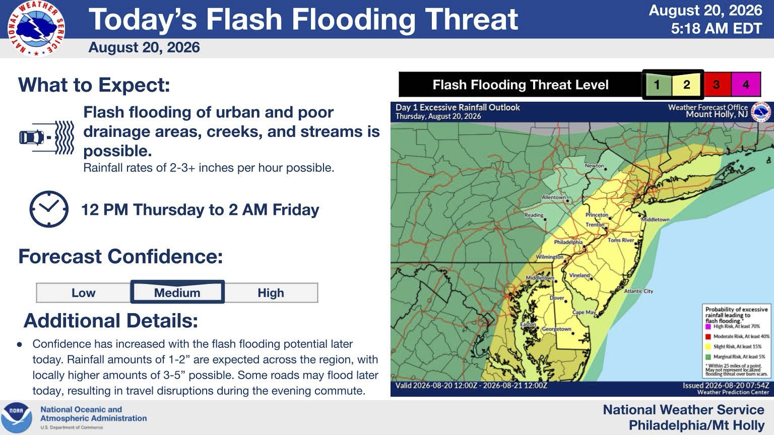
Hazardous Weather: Heavy downpours with rainfall rates of up to 2 to 4 inches per hour could occur in Chester County resulting in localized flash flooding of urban and poor drainage areas, creeks, and streams. Scattered severe thunderstorms are also expected with damaging winds being the primary threat, although hail and a few tornadoes are possible.
Locations Affected: All of Chester County is under the Flood Watch.
Timing: The Flood Watch is in effect from 12:00 PM today until 2:00 AM Friday. Within that window, the greatest threat for severe thunderstorms will be between 2:00 PM and 10:00 PM today.
Impacts: Localized flash flooding may result in road closures and water level rises in local rivers and streams. Isolated damaging wind gusts, hail, and tornadoes may result in localized tree damage and power outages. Disruptions to the evening commute are likely.
Confidence of Occurrence: There is a moderate level of confidence in both the severe weather and flooding forecast for today.